|
|
||||||||||||||
  School of Computational Sciences CAMP Home People Research Simulation gallery ├ Hurricane predictions ├ Higher-order upwind schemes on unstructured meshes ├ Urban scale simulation └ Advanced statistical methods (neural networks) Publications Resources for students Data archive Annual conference Computing resources Related links About our webpage Contact us |
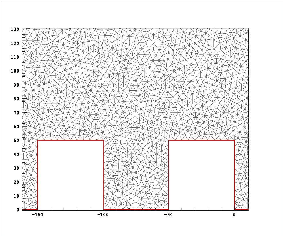
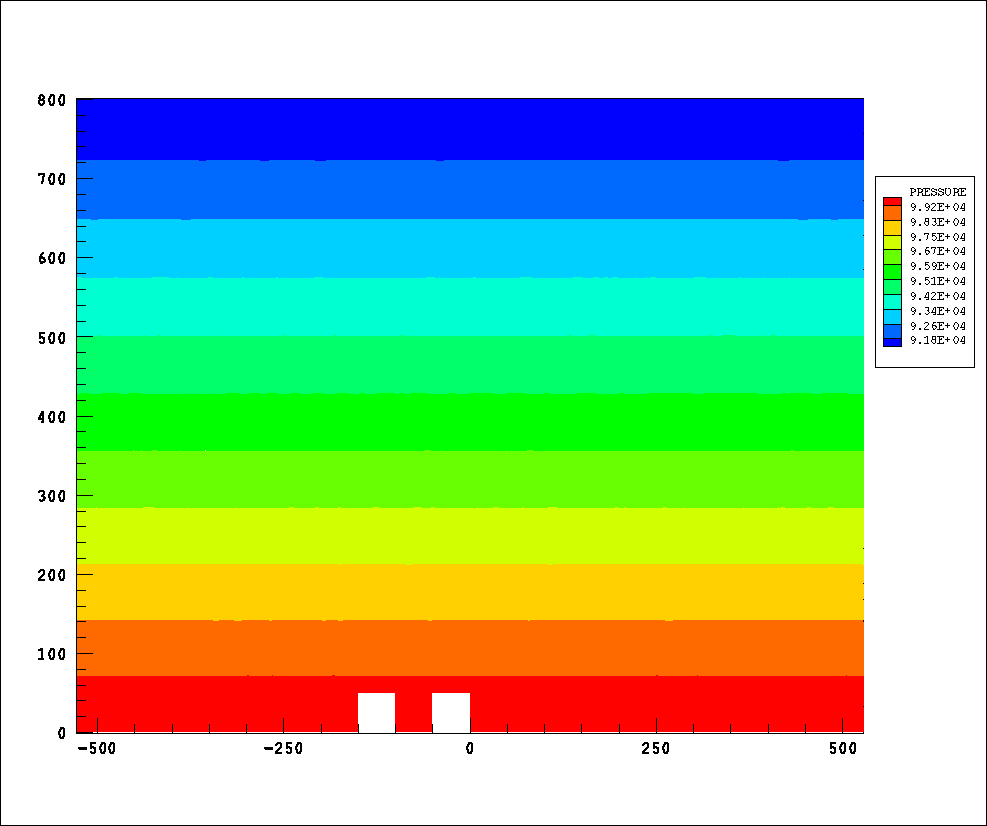
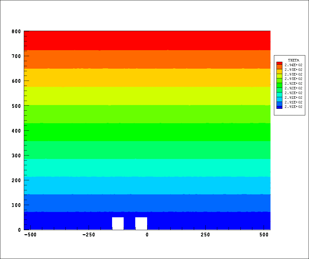
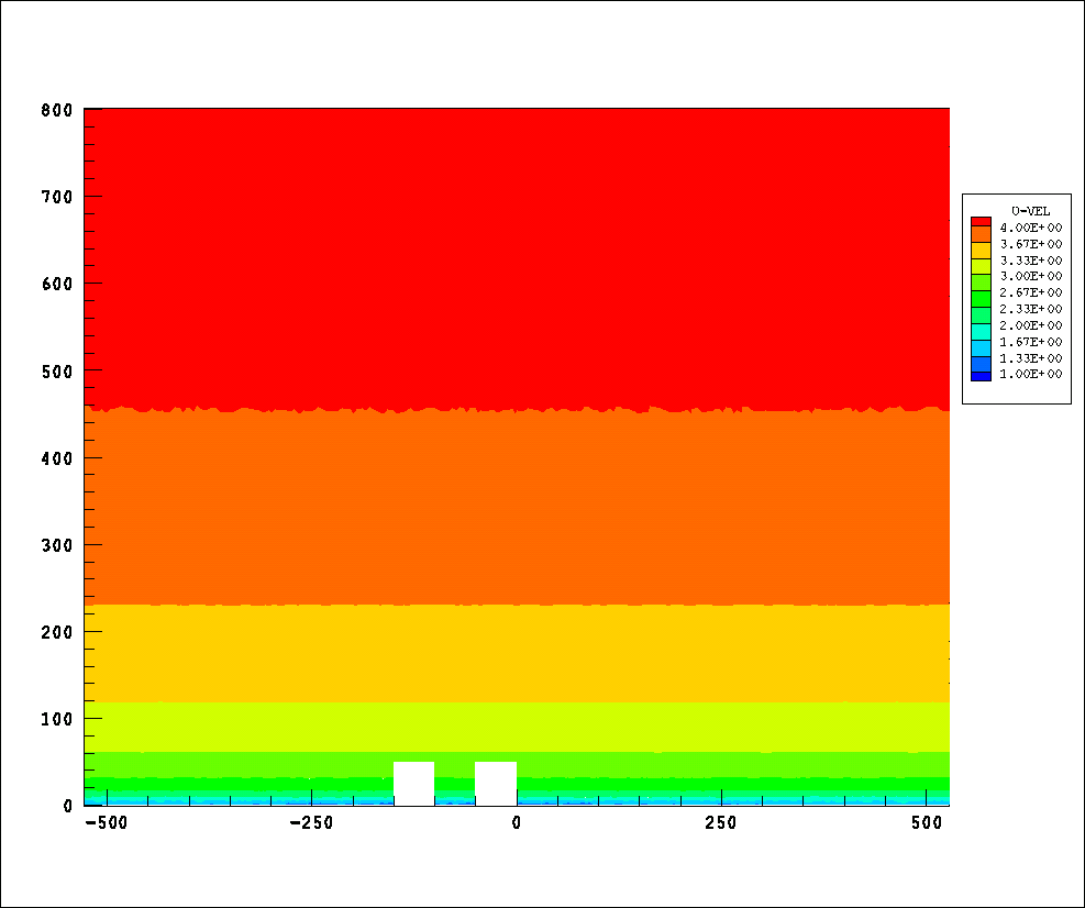
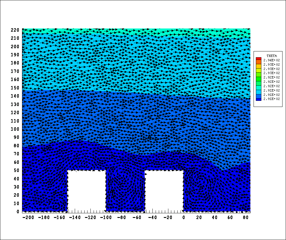
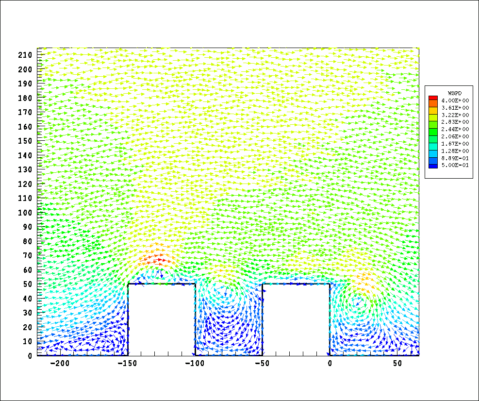
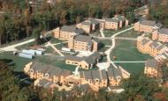
Urban scale simulationsA higher-order Godunov-type scheme for unstructured triangular meshes has been developed for non-hydrostatic atmospheric flows. The HLLC approximate Riemann solver was adapted for the governing equation set to calculate the Godunov fluxes. The method was extended to higher-order spatial accuracy using gradient reconstruction techniques. A four-stage Runge-Kutta time-marching scheme was used for higher-order accuracy in time. A case of flow over obstacle (urban street canyon) is then simulated. This simulation is conducted to demonstrate the flexibility of using unstructured grids when it comes to simulating flows over different types of geometries.An urban street canyon was defined by two buildings of equal widths and heights (50 m) separated by a distance of 50 m. The domain extended to 800 m in the vertical and from -750 m to 750 m in the horizontal. The mesh consisted of 66585 cells with edge lengths varying from 2.19 m to 12.14 m. The domain was initialized for a stable atmosphere in hydrostatic equilibrium. The horizontal flow field was initialized with a log-profile. The vertical component of velocity was set to zero. The model was able to resolve the main flow features expected in a street canyon, such as the vortices behind and at the top of the first building and in front of the second building. The skimming flow over the canyon and the weak circulation inside the canyon was also resolved. A zoomed view of the mesh, initial conditions for the simulation and the flow over the urban canyon are shown in the following figures. Click on the images for enlarged views (sizes: 101KB, 16KB, 16KB, 16KB, 104KB and 97KB, respectively).
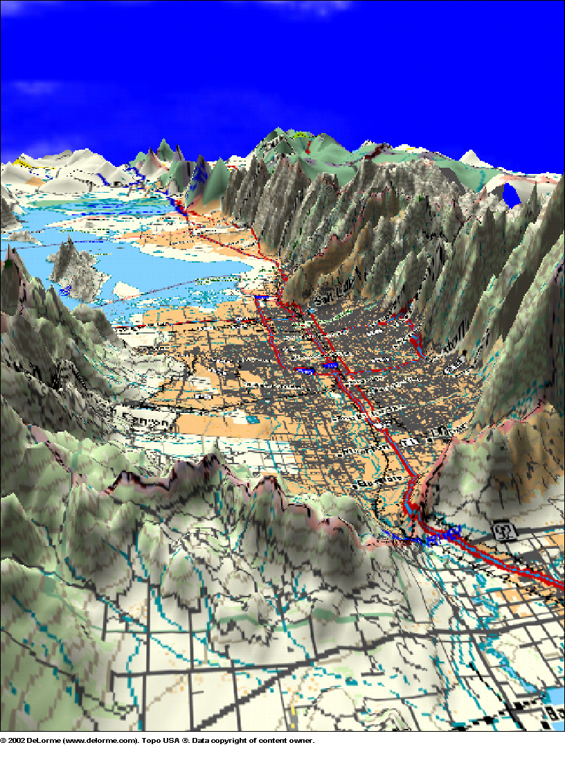
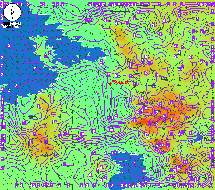
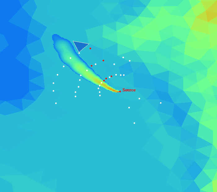
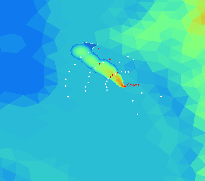
OMEGA model simulation depicting plume transport for the first release of IOP10 in the Salt Lake City Valley; a) high resolution (1 km) grid configuration over the SLC area, b) land use land cover data showing the boundaries of SLC, c) 3d terrain view of the area, d) animation of the resulting wind barbs and wind speed contours above urban canopy height, 75m over a 3 hour period, e) plume dispersion without urban canopy parameterization and f) plume dispersion with urban canopy parameterization scheme. Note that the plume results are presented in a zoomed area where the Urban 2000 experiment took place in Salt Lake City. White dots shows the tracer measurement locations, while red dots indicate the spread of measured cloud. The release location is also indicated with a red dot as "Source". The separation between the three major monitoring arcs is about 2 km. Click on the images for enlarged views (sizes: 73KB, 30KB, 466KB, 3.3MB(avi), 27KB and 26KB, respectively).
See the
contact page for detailed
information on
contacting us. |
|||||||||||||