|
|
|||||||||||||
  School of Computational Sciences CAMP Home People Research Simulation gallery ├ Hurricane predictions ├ Higher-order upwind schemes on unstructured meshes ├ Urban scale simulation └ Advanced statistical methods (neural networks) Publications Resources for students Data archive Annual conference Computing resources Related links About our webpage Contact us |
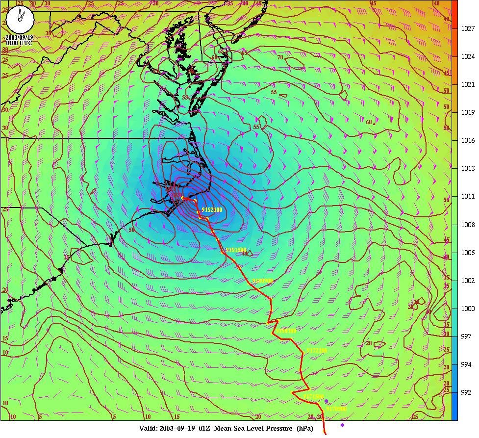
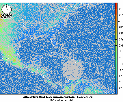
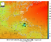
Hurricane predictions1. Hurricane IsabelleThe following graphics show a satellite view and a forecast output from the Operational Multiscale Environment model with Grid Adaptivity (OMEGA). The model was initialized using analysis from NCEPs AVN model (valid as 8:00 pm EDT 9/15/2003). The grid resolution was better than 20 km in the storm region. The picture shows the 73 hr forecast valid for 9:00 pm EDT, 9/18/2003. The colored background is the mean sea level pressure. The contour lines represent the wind speed in knots. The wind direction and speed are also indicated by the wind barbs. The model predicted track is indicated by the red trace. Click on the images for enlarged views (sizes: 424KB and 412KB, respectively).
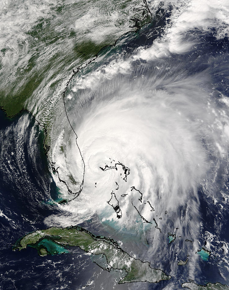
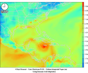
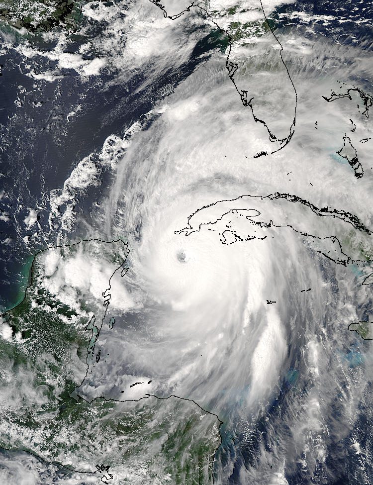
2. Hurricane Frances The following pictures and animation show the recent prediction of Hurricane Frances. The model prediction shows that Frances landed near Cape Canaveral on 09/04/2004 around noon. This is very slow moving hurricane that is category 3 (with wind speed of about 100-120 miles/hr). The model results also show that the high pressure system that sinks from Canada located in the north is preventing this hurricane to turn towards north. It is expected that Frances will move cross Florida and then turn north to Georgia and finally dissipate. The two big concern is that since this is a very slow moving hurricane, it may cause a lot damage and economical lost while it crosses the Florida peninsula and also associated storm surge may cause flooding. Potentially this hurricane could be the second most devastating hurricane of recent years after 1992 Hurricane Andrew which cost $20 billion economical lost. The following GIF image and the movie show 92 hours of model simulation. The satellite image has been produced by Satellite Terra (pixel size: 2km) and shows Hurrican Frances on 09/04/2004 at 16:00 UTC. Image courtesy of MODIS Rapid Response Project at NASA/GSFC. Click on the images for enlarged views (sizes: 80KB, 3.7MB, and 197KB, respectively).
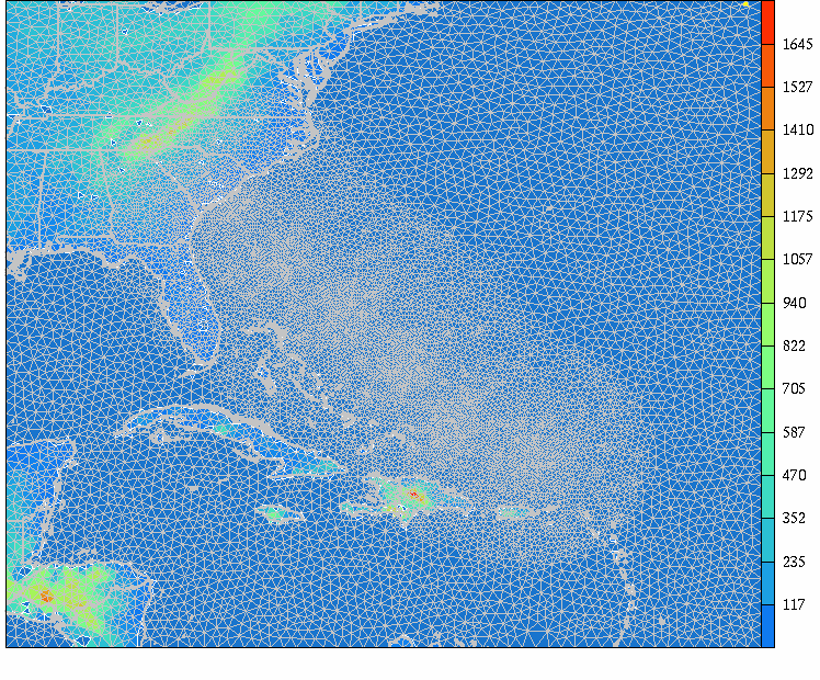
3. Hurricane Ivan The following animations are from the results of the prediction of Hurricane Ivan. The simulation has been carried out with dynamically adapting grid, refining only the vicinity of the hurricane. The satellite image has been produced by Satellite Aqua (pixel size: 2km) and shows Hurrican Ivan on 09/13/2004 at 19:00 UTC. Image courtesy of MODIS Rapid Response Project at NASA/GSFC. Click on the images for enlarged views of the animations on the evolving adapting grid (3.4MB), mean sea-level pressure (4.1MB), column-integrated vapor (5.7MB) and the satellite image (209KB).
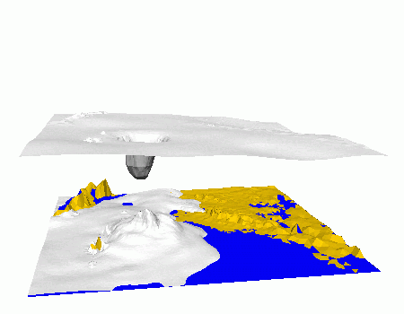
4. Hurricane Floyd Simulation of Hurricane Floyd using the Operational Multiscale Environment model with Grid Adaptivity (OMEGA). The animation shows the formation, evolution and finally the dissipation of hurricane as it makes landfall on the coast of North Carolina. The mountains of Central America are visible in the far bottom left corner of the image. The gray isosurface (at 355 K) is for the equivalent potential temperature. The equivalent potential temperature is a good indicator of the hurricane core. The scale in the vertical has been exagerated. Click on the image for enlarged view (size: 565KB).
See the
contact page for detailed
information on
contacting us. |
||||||||||||